Maps 3D PRO v4.1.2
This post was published 7 years ago. Download links are most likely obsolete. If that's the case, try asking the uploader to re-upload.
Maps 3D PRO v4.1.2 | 19,9 MB
Requirements: Requires iOS 7.0 or later. Compatible with iPhone, iPad, and iPod touch.
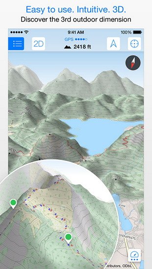
Enjoy exploring the great outdoors? If you’re a fan of biking, hiking and running then Maps 3D is the ideal app designed for planning your outdoor adventures. Whereas other mapping apps are primarily designed for cities and roads, displaying hills and mountains as flat and lifeless features, Maps 3D is packed with amazing features that brings the great outdoors to vibrant life with valleys, hills, mountains and footpaths displaying in full 3D so you’ll know your exact elevation.
STORE ROUTES & USE OFFLINE
With Maps 3D you’ll have the option to plan, record and share your routes, turning your iPhone into a fully-fledged GPS device so you can log key coordinates and elevations. You’ll also have offline access to worldwide 3D map data which limits the drain on the battery and means that you can pre-load maps to store when you don’t have a signal.
SEARCHABLE MAPS
As an added bonus Maps 3D offers 3D terrain and trip planning, so you’ll never need to worry about getting lost. Towns, streets, mountain peaks and lakes are all searchable, with an accurate and precise map display based on NASA scans of the Earth’s surface combined with the outdoor map OSM (Open Street Map) and the Official USGS topo maps.
LOAD YOUR TRIPS & SHARE
GPX-tracks can be imported via iTunes, EveryTrail, email, URL or Dropbox, and recorded tracks can be shared via email, Facebook and Twitter, great for showing your friends your latest outdoor accomplishments.
MORE FEATURES
- Load maps in advance over WIFI or 3G before your trek, no internet connection needed thereafter
- Record your routes by GPS, all coordinates and exact elevations are logged
- Plan and evaluate routes directly in the 3D map view
- Search for towns, streets , mountain peaks, lakes - offline
- Distance traveled, current and average speeds all displayed for an ideal trek
GENERAL / NOTES
Background GPS recording can significantly cut battery life
What's New
v4.1.2
– Use your photo library to add images to waypoints
– Improvement for iPhone 6S/6S Plus when using route planning
– Solving a problem with waypoint export under iOS 9.3
– Minor bug fixes
Homepage
https://itunes.apple.com/en/app/maps-3d-pro-gps-tracks-for/id391304000?mt=8&ign-mpt=uo%3D4

Rapidgator.net
http://rg.to/file/1a3b3f20d46772e48614079a1ef646a5/Maps.3D.PRO.v4.1.2.softarchive.la.ipa.html
Nitroflare.com
http://nitroflare.com/view/BDD283CB543196A/Maps.3D.PRO.v4.1.2.softarchive.la.ipa
